Product Information
Includes GPS coordinates of accommodation facilities, visitor's centres, adventure sites, points of interest, landmarks, towns, fuel stops, intersections and more. You will find descriptive multi-language icons indicating the type of facility (e.g. lodge, camp, hotel) as well as activities icons (e.g. abseiling, tennis, fishing, golf and many more). Road, tracks, 4x4 tracks and even hiking trails are included.
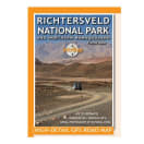
Richtersveld National Park InfoMap
MVBK001